Adam’s Peak
The amazing Adam’s Peak is Sri Lanka’s fourth highest mountain at 2,244m and is located 40km northeast of Ratnapura.
Adam’s Peak or the Sri Pada is an important pilgrim site. Buddhist believe the impression on the summit is the footprint of lord Buddha himself. Though it takes around 5 hours to reach the peak by foot, devotees of many religions climb the mountain daily to invoke blessings. The mountain is also named as Samanala Kanda or Butterfly Mountain.
Rich biodiversity
Adam’s Peak is surrounded, largely by the forested hills, with no mountain of comparable size anywhere near the vicinity. The region of Peak Wilderness Sanctuary that encompass the Adam’s Peak together with Horton Plains National Park and Knuckles Range, all in the Central Highlands of Sri Lanka is recognized as a World Heritage Site in the year 2011.
Begin from the Base
The city of Hatton can be reached by Highland Railway line as well as by the main motor roads, the cities of Ratnapura and Kuruwita can be reached only by main motor roads.
Access to the Adam’s Peak is possible by 6 trails: Hatton-Nallathanni; Ratnapura-Palabaddala; Kuruwita-Erathna; Murraywatte; Mookuwatte; Malimboda.
The most popular routes are the Hatton-Nallathanni & Ratnapura-Palabaddala due to the picturesque views and postcard worthy scenery that can be encountered along them.
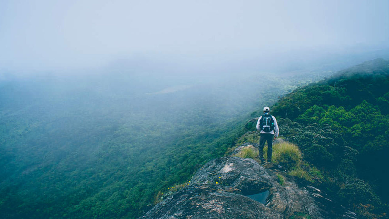
Reaching the Peak
Once you reach a final node (Nallanthanni or Palabaddala or Erathna) there begins the difficult journey through the jungle on foot. Most of the pilgrims use the Hatton route as the journey can be reduced by more than five kilometers even though the slope of this route is much greater than the others.
The Season and Timing
The pilgrims season to Sri Pada traditionally starts on the full moon of December and ends on the full moon of April. During the first half of the season the night ascent isn’t crowded. However during the latter half of the season, more people attempt the climb with each passing day..
Night Ascension
The greater part of the track leading from the base to the summit of Adam’s peak consists of dozens of steps built in cement or rough stones being illuminated with electric power lines. The night ascent is safe even when accompanying kids. With the track having night rest stops and wayside stalls and kiosks that serve refreshments, the goal of reaching the summit on time to enjoy the spectacle of sunrise made even easier and less tiresome.
You could also arrange to climb up during the day, camp overnight enjoying the starry spectacle at the summit, witness the majesty of the beautiful sunrise the following morning and then descend. The daytime ascent affords the luxury to climb at a leisurely pace and have plenty of time to enjoy the views all round.
Accommodation on the summit of Adam’s peak is basic and you would have to bring your own food and perhaps a blanket or sleeping bag. However, whenever you decide to go, check the weather report before setting out. Rain can make for a miserable trip and it is more likely that cloud or mist will obscure the view.
The Sama Chatiya at Adam’s Peak
On the way up, after a few minutes climb you can find the Sama Chatiya, the World Peace Pagoda.
This stupa was built by the famous Japanese Buddhist monk Ven Nichi Fuji in 1976.

 基里加尔波塔
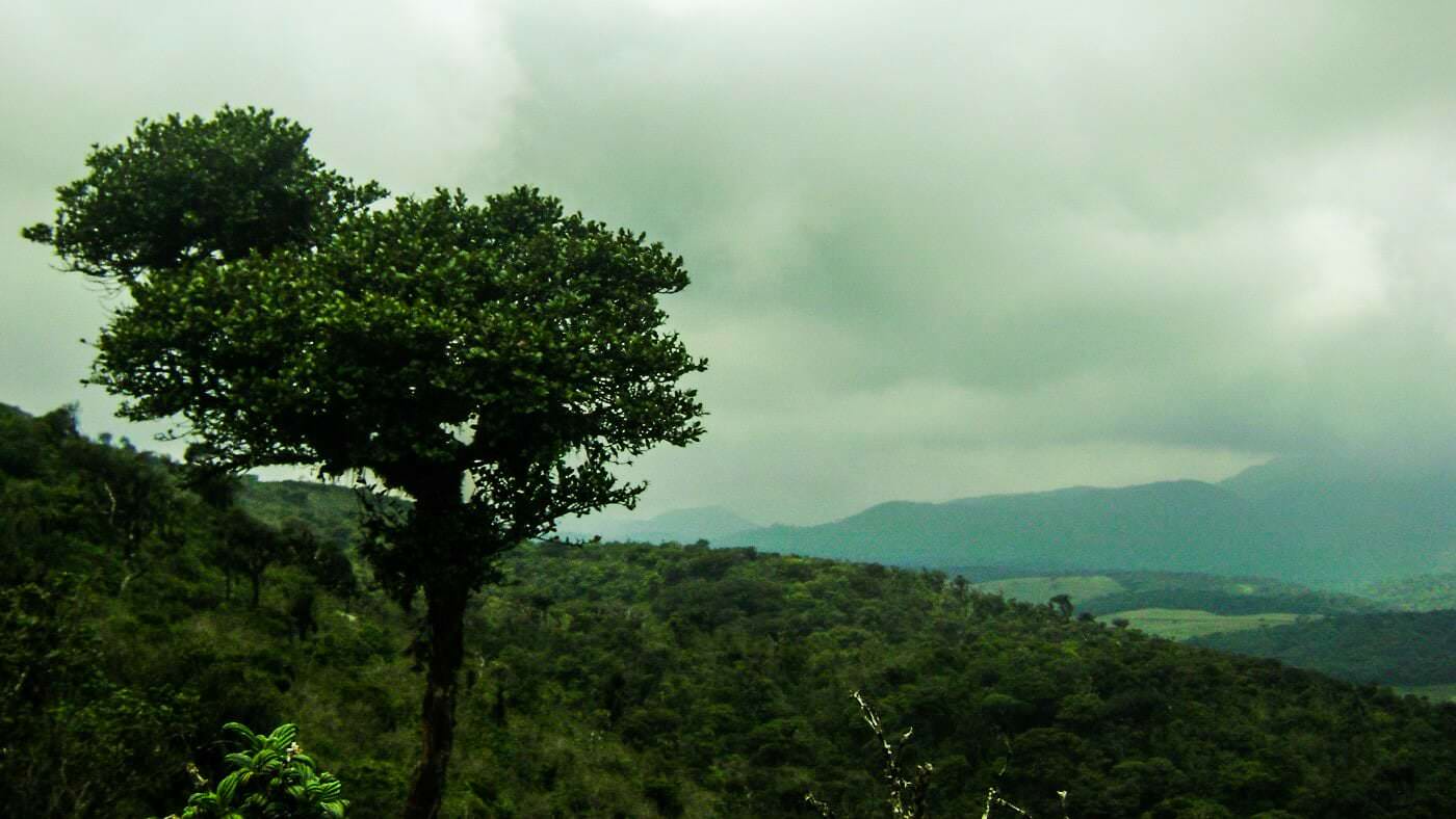 托图波拉·坎达
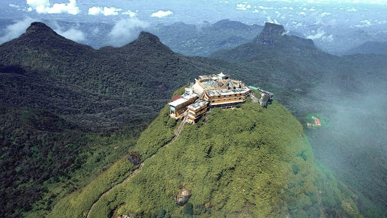 亚当峰(斯里帕达山)
 哈克加拉峰
哈克加拉峰 戈莫利亚
戈莫利亚 班巴拉坎达峰
 里弗斯顿峰
里弗斯顿峰


