
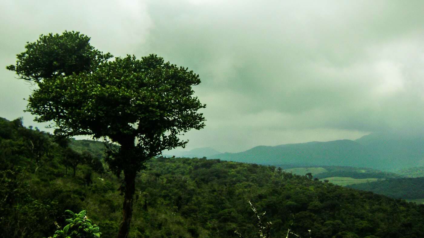
Kirigalpotta


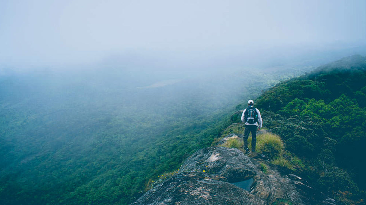
Kirigalpoththa mountain in Sri Lanka – The Second Tallest Mountain on the Island. Reaching upto 2388m (7835 feet) above mean sea level, Kirigalpoththa Mountain in Sri Lanka looms in the district of Nuwara Eliya casting its shadow over the main city.The name Kirigalpoththa literally translates to Milk (Tree) Bark Rock (Kiri – milk, gal – rock and poththa- tree bark), possibly because the mountain has many tall trees with mottled white bark. Reached by a nature trail in the Horton Plains National Park; this mountain is the second tallest of the island paradise Sri Lanka, and the tallest of the mountains in the island whose summits are are open to access to the general public.
Kirigalpoththa mountain in Sri Lanka: Some Things to Know
- Location : Nuwara Eliya District
- Nearest Village : Pattipola
- Nearest Town : Nanuoya
- Trail to climb Kirigalpoththa is located at : Horton Plains National Park
- Trail Head : Horton Plains Visitor Centre
- Trail End : Kirigalpoththa Summit
- Length of Trail : 5.6 km
- Elevation Gain : 252m (Elevation at Trail Head: 2139m – Elevation at Trail End: 2392m)
- Climb Difficulty Level : Moderate
- Climb Time : 3 – 4 hours
- Weather Conditions : The Nuwara Eliya area is usually cold and rainy in general. But it is more so in the monsoon months. The dryest months comparatively speaking are February to April and July to September. Strong winds and cold weather are almost guaranteed higher up on the trail.
- Permit Required : Yes. Can be obtained at the entrance of Hortons Plains National Park
- Things to take on your climb: Water bottle, light sweater, raincoat, bug spray and salt for leeches, first aid equipment such as plaster, disinfectant, and bandages. (Some strong climbing rope may also be advantageous)
- Clothes to be worn : Thick clothes that will protect your skin from brambles and such and tall skidproof boots to avoid slipping in mud.
- Other tips: Do not stray from the established trail as the plain is marshy. Do not attempt as a solo climber.


-
 基里加尔波塔
基里加尔波塔山位于斯里兰卡努瓦拉埃利亚区,海拔高达2388米(7835英尺),巍峨耸立,为这座主要城市投下阴影。这座山峰是斯里兰卡第二高峰,也是岛上最高的山峰。
-
 托图波拉·坎达
托塔波拉坎达山是斯里兰卡第三高峰,位于努瓦拉埃利亚区,海拔2357米。这座山峰坐落在霍顿平原国家公园内。一条通往山顶的步道长约两公里,起点距离霍顿平原国家公园的帕蒂波拉入口仅几米之遥。
-
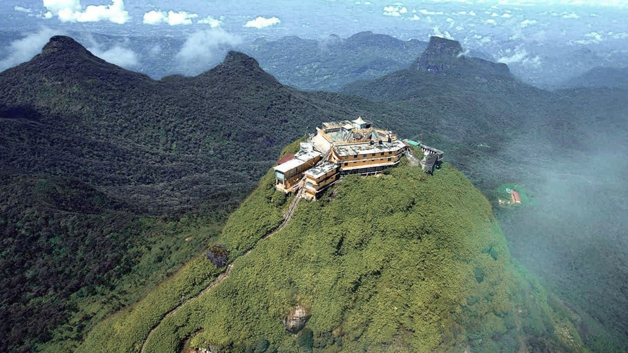 亚当峰(斯里帕达山)
锡兰最著名的自然景观是亚当峰,它位于拉特纳普勒区。它位于中央山脉边缘,但其周围的群山被称为“山峰荒野”。它海拔约7500英尺,是该国第二高峰。
-
 哈克加拉峰
哈克加拉峰哈克加拉峰位于斯里兰卡中部高地,坐落在哈克加拉严格自然保护区内。它靠近努瓦拉埃利亚镇,是中部高地地区的一部分,该地区以其迷人的风景和凉爽的气候而闻名。
-
 戈莫利亚
戈莫利亚戈莫利亚峰是斯里兰卡中部纳克尔斯山脉的一部分,该山脉是联合国教科文组织世界遗产,以其生物多样性和秀丽的自然风光而闻名。这座山峰位于斯里兰卡中部高地的康提区。
-
 班巴拉坎达峰
班巴拉坎达峰位于斯里兰卡乌瓦省巴杜勒区,地处中部高地,毗邻斯里兰卡最高的瀑布——著名的班巴拉坎达瀑布。该地区以其郁郁葱葱的植被、凉爽的气候和令人叹为观止的自然美景而闻名。
-
 里弗斯顿峰
里弗斯顿峰从马特莱镇出发,沿着马特莱-吉兰杜鲁科特公路行驶约30公里,即可到达斯里兰卡的里弗斯顿峰。这条蜿蜒曲折、弯道急促的公路,沿途可欣赏到周边乡村的绝美景色,因此也被称为“迷你世界尽头”。


